
Could Eastern Iowa See Its First Frost Before the Weekend?
Fall weather in Iowa can be a bit like a rollercoaster. Warm temperatures one day, and the next you're bringing in your plants from the porch! We'll see a weather swing just like that this week. Say goodbye to the summer-like weather!
One More Warm Day
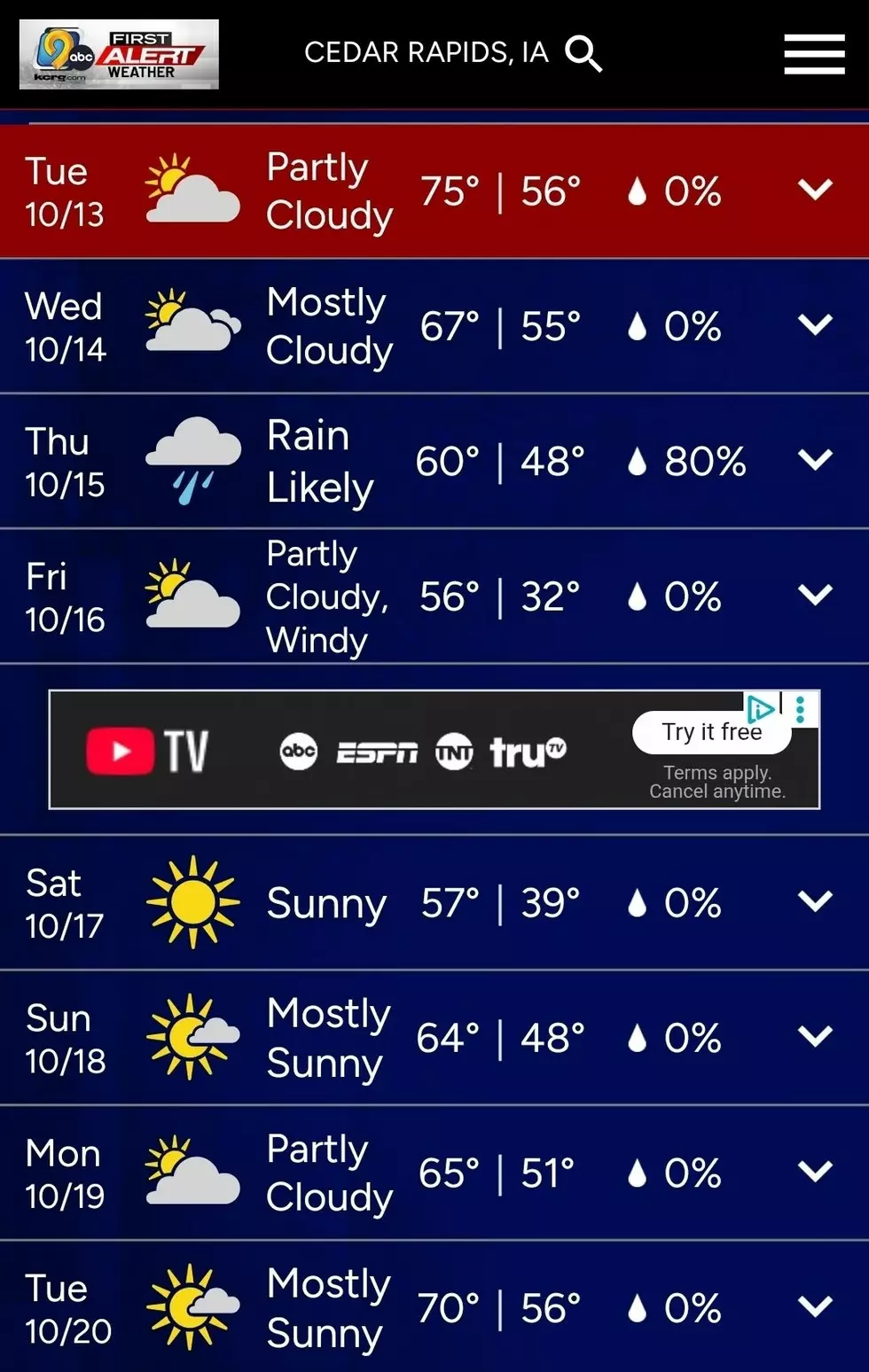
It looks like today will be our last day for above-normal temperatures across Eastern Iowa. According to our weather partner KCRG TV-9, high temperatures today will reach the mid-to-upper 70s. But a cold front will bring cooler weather our way, as well as a chance of showers and thunderstorms.
Here Comes The Rain
The best chance at rain comes late Tuesday into Wednesday morning, according to KCRG. Chances for heavy rain will be greater along the Iowa-Missouri border, but everyone south of Highway 20 will have a chance of showers. Most of the day Wednesday appears dry, but another chance of measurable rain returns into the day Thursday, where some areas of Eastern Iowa could see up to one inch of rain. KCRG reports that issues with flooding are not expected.
Our First Frost of the Year?
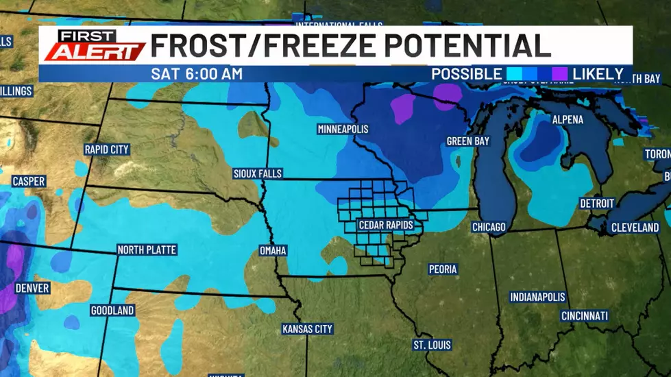
After the rain moves out, cooler temperatures move in. So does the wind. KCRG reports that gusts on Friday could reach 45 mph! As the winds die down Friday night, the temperatures plummet, and we have our first real chance at a hard freeze and frost of the season. KCRG notes that this is typically a little later than normal for a first frost in Eastern Iowa.
But don't panic. Winter isn't coming quite yet. KCRG reports that temperatures stretch back into the upper 60s to near 70 again next week.
I'm done with highs in the 80s in October. Here's hoping for some nice crisp, cool, fall days to come!

Fall Photos from Palisades-Kepler State Park Near Mt. Vernon
Gallery Credit: Julie James
Coldest Morning in Cedar Rapids History
Gallery Credit: Julie James